Contour Mapping
-
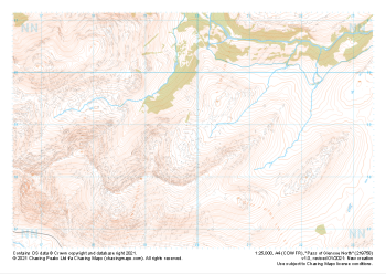 "Pass of Glencoe North" Major Hazards£4.99
1:25,000 scale map covering Pass of Glencoe North in the Scottish Highlands (approx. center NN199589).
Learn More -
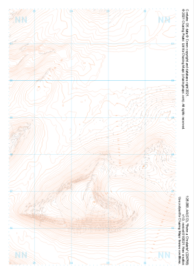 "Beinn a Chrulaiste" Landform£4.99
1:25,000 scale map covering Beinn a Chrulaiste in the Scottish Highlands (approx. center NN246585).
Learn More -
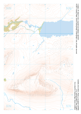 "Beinn a Chrulaiste" Natural Features£4.99
1:25,000 scale map covering Beinn a Chrulaiste in the Scottish Highlands (approx. center NN246585).
Learn More -
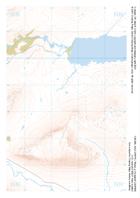 "Beinn a Chrulaiste" Major Hazards£4.99
1:25,000 scale map covering Beinn a Chrulaiste in the Scottish Highlands (approx. center NN246585).
Learn More -
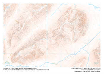
 "Buachaille Etive Mor" Landform£4.99
1:25,000 scale map covering Buachaille Etive Mor in the Scottish Highlands (approx. center NN204533).
Learn More -
 "Buachaille Etive Mor" Natural Features£4.99
1:25,000 scale map covering Buachaille Etive Mor in the Scottish Highlands (approx. center NN204533).
Learn More -
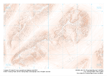
 "Buachaille Etive Mor" Major Hazards£4.99
1:25,000 scale map covering Buachaille Etive Mor in the Scottish Highlands (approx. center NN204533).
Learn More -
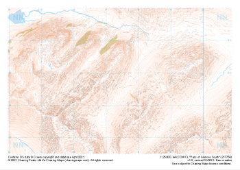
 "Pass of Glencoe South" Landform£4.99
1:25,000 scale map covering Pass of Glencoe South in the Scottish Highlands (approx. center NN174547).
Learn More -
 "Pass of Glencoe South" Natural Features£4.99
1:25,000 scale map covering Pass of Glencoe South in the Scottish Highlands (approx. center NN174547).
Learn More -
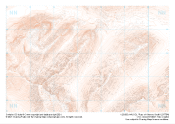
 "Pass of Glencoe South" Major Hazards£4.99
1:25,000 scale map covering Pass of Glencoe South in the Scottish Highlands (approx. center NN174547).
Learn More