Contour Mapping
-
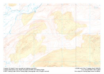
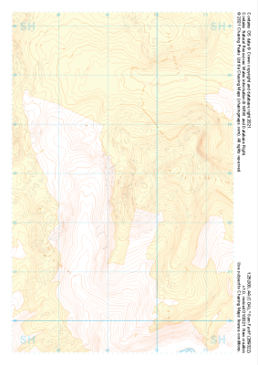 "Garn Fach" Landform+£4.99
1:25,000 scale map covering Garn Fach in the North Wales (approx. center SH693228).
Learn More -
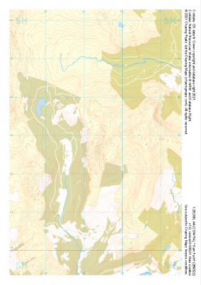 "Garn Fach" Natural Features£4.99
1:25,000 scale map covering Garn Fach in the North Wales (approx. center SH693228).
Learn More -
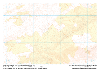
 "Garn Fach" Major Hazards£4.99
1:25,000 scale map covering Garn Fach in the North Wales (approx. center SH693228).
Learn More -
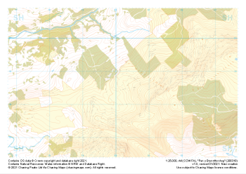
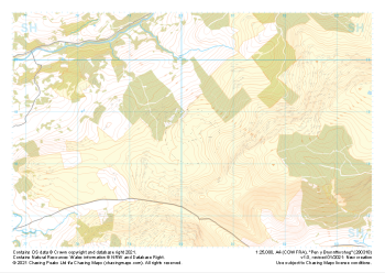
 "Pen y Brynnfforchog" Landform+£4.99
1:25,000 scale map covering Pen y Brynnfforchog in the North Wales (approx. center SH802187).
Learn More -
 "Pen y Brynnfforchog" Natural Features£4.99
1:25,000 scale map covering Pen y Brynnfforchog in the North Wales (approx. center SH802187).
Learn More -
 "Pen y Brynnfforchog" Major Hazards£4.99
1:25,000 scale map covering Pen y Brynnfforchog in the North Wales (approx. center SH802187).
Learn More -
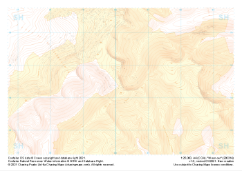 "Waun-oer" Landform+£4.99
1:25,000 scale map covering Waun-oer in the North Wales (approx. center SH802145).
Learn More -
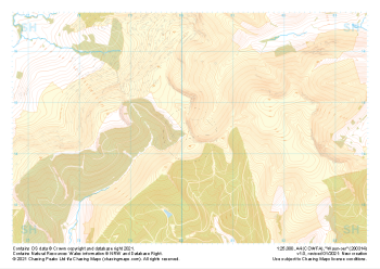 "Waun-oer" Natural Features£4.99
1:25,000 scale map covering Waun-oer in the North Wales (approx. center SH802145).
Learn More -
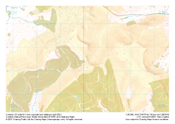 "Waun-oer" Major Hazards£4.99
1:25,000 scale map covering Waun-oer in the North Wales (approx. center SH802145).
Learn More -
 "Dolgellau West" Landform+£4.99
1:25,000 scale map covering Dolgellau West in the North Wales (approx. center SH683159).
Learn More