Contour Mapping
-
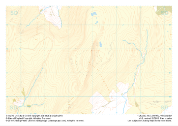 "Whernside" Natural Features£4.99
1:25,000 scale map covering Whernside in the Yorkshire Dales (approx. center SD738814).
Learn More -
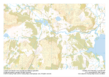
 "Ingleborough" Major Hazards£4.99
1:25,000 scale map covering Ingleborough in the Yorkshire Dales (approx. center SD741746).
Learn More -
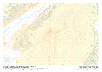 "Ingleborough" Natural Features£4.99
1:25,000 scale map covering Ingleborough in the Yorkshire Dales (approx. center SD741746).
Learn More -
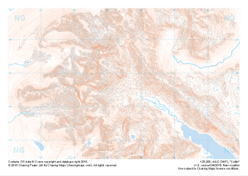 "Cuillin" Natural Features£4.99
1:25,000 scale map covering the famous Cuillin Ridge on the Isle of Skye (approx. center NG455225).
Boasting some of the most remote mountaineous terrain in the UK, the Cuillin Hills are described by some as the Pyrenneas of the North. Should you be lucky enough to find them on a very rare rain, mist and midge free day, they can truly feel like an outing in the Italian Alps. On any other day this complex terrain is not for the faint hearted and almost all approaches to the significant peaks will require a very good head for heights and well above average mountaineering and navigation skills.
Learn More -
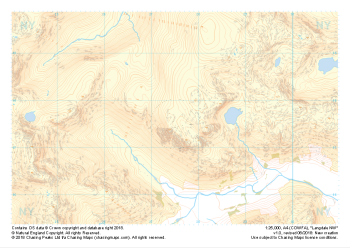
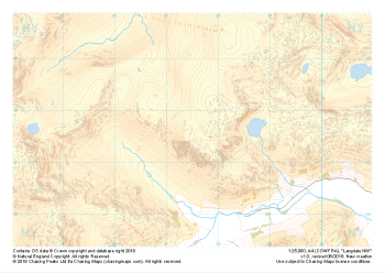 "Langdale NW" Major Hazards£4.99
1:25,000 scale map covering Langdale's North West corner (approx. center NY275075).
Known for its stunning countryside, tricky navigational terrain and beautiful wild camping spots, the Langdale Fells provide a true mountain adventure for every type of explorer.
Learn More -
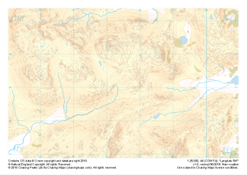
 "Langdale NW" Natural Features£4.99
1:25,000 scale map covering Langdale's North West corner (approx. center NY275075).
Known for its stunning countryside, tricky navigational terrain and beautiful wild camping spots, the Langdale Fells provide a true mountain adventure for every type of explorer.
Learn More -
 "Langdale SW" Natural Features£4.99
1:25,000 scale map covering Langdale's North West corner (approx. center NY275075).
Known for its stunning countryside, tricky navigational terrain and beautiful wild camping spots, the Langdale Fells provide a true mountain adventure for every type of explorer.
Learn More -
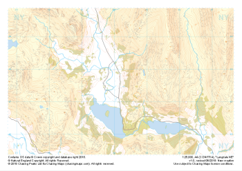 "Langdale NE" Major Hazards£4.99
1:25,000 scale map covering Langdale's North East corner (approx. center NY345075).
Known for its stunning countryside, tricky navigational terrain and beautiful wild camping spots, the Langdale Fells provide a true mountain adventure for every type of explorer.
Learn More -
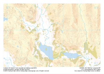 "Langdale NE" Natural Features£4.99
1:25,000 scale map covering Langdale's North East corner (approx. center NY345075).
Known for its stunning countryside, tricky navigational terrain and beautiful wild camping spots, the Langdale Fells provide a true mountain adventure for every type of explorer.
Learn More -
 "Langdale SE" Major Hazards£4.99
1:25,000 scale map covering Langdale's South East corner (approx. center NY345035).
Known for its stunning countryside, tricky navigational terrain and beautiful wild camping spots, the Langdale Fells provide a true mountain adventure for every type of explorer.
Learn More