Contour Mapping
-
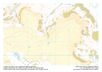
 "Mynydd Llangatwg East" Major Hazards£4.99
1:25,000 scale map covering Mynydd Llangatwg East in the South Wales (approx. center SO206133).
Learn More -
 "Hatterall Hill" Natural Features£4.99
1:25,000 scale map covering Hatterall Hill in the South Wales (approx. center SO305264).
Learn More -
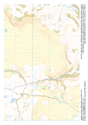
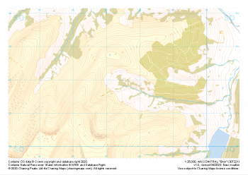
 "Bryn" Natural Features£4.99
1:25,000 scale map covering Bryn in the South Wales (approx. center SO075218).
Learn More -
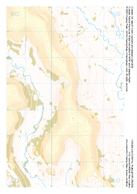
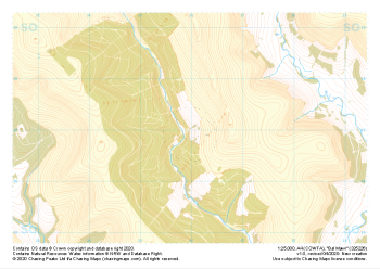
 "Bryn" Major Hazards£4.99
1:25,000 scale map covering Bryn in the South Wales (approx. center SO075218).
Learn More -
 "Bal Mawr" Natural Features£4.99
1:25,000 scale map covering Bal Mawr in the South Wales (approx. center SO260269).
Learn More -
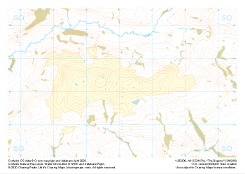 "The Begwns" Natural Features£4.99
1:25,000 scale map covering The Begwns in the South Wales (approx. center SO161441).
Learn More -
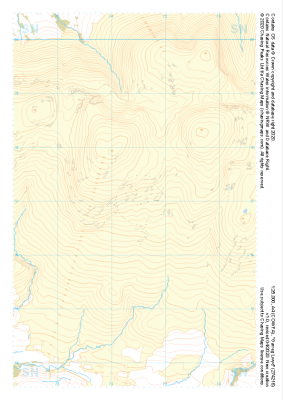 "Garreg Lwyd" Natural Features£4.99
1:25,000 scale map covering Garreg Lwyd in the South Wales (approx. center SN744169).
Learn More -
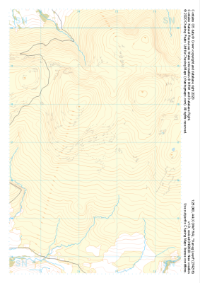 "Garreg Lwyd" Major Hazards£4.99
1:25,000 scale map covering Garreg Lwyd in the South Wales (approx. center SN744169).
Learn More -
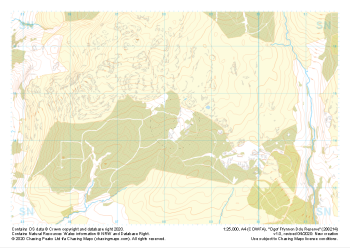 "Ogof Ffynnon Ddu Reserve" Natural Features£4.99
1:25,000 scale map covering Ogof Ffynnon Ddu Reserve in the South Wales (approx. center SN882144).
Learn More -
 "Blorenge" Natural Features£4.99
1:25,000 scale map covering Blorenge in the South Wales (approx. center SO257114).
Learn More