Contour Mapping
-
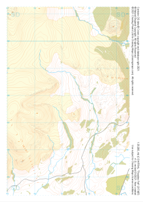 "Thwaites Fell" Major Hazards£4.99
1:25,000 scale map covering Thwaites Fell in the Lake District (approx. center SD172878).
Learn More -
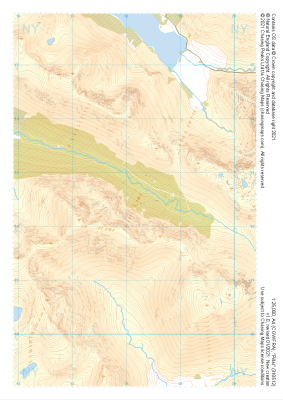
 "Pillar" Natural Features£4.99
1:25,000 scale map covering Pillar in the Lake District (approx. center NY182125).
Learn More -
 "Pillar" Major Hazards£4.99
1:25,000 scale map covering Pillar in the Lake District (approx. center NY182125).
Learn More -
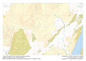 "Walna Scar" Natural Features£4.99
1:25,000 scale map covering Walna Scar in the Lake District (approx. center SD267948).
Learn More -
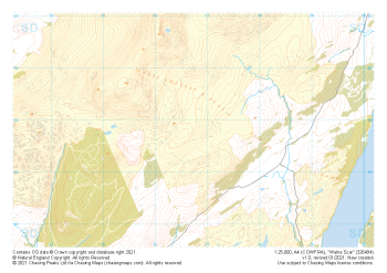 "Walna Scar" Major Hazards£4.99
1:25,000 scale map covering Walna Scar in the Lake District (approx. center SD267948).
Learn More -
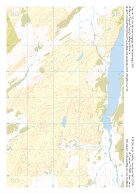 "Woodland Fell" Natural Features£4.99
1:25,000 scale map covering Woodland Fell in the Lake District (approx. center SD275910).
Learn More -
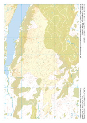
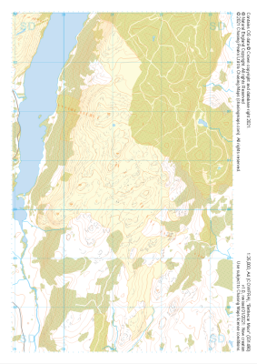
 "Woodland Fell" Major Hazards£4.99
1:25,000 scale map covering Woodland Fell in the Lake District (approx. center SD275910).
Learn More -
 "Bethecar Moor" Natural Features£4.99
1:25,000 scale map covering Bethecar Moor in the Lake District (approx. center SD312906).
Learn More -
 "Bethecar Moor" Major Hazards£4.99
1:25,000 scale map covering Bethecar Moor in the Lake District (approx. center SD312906).
Learn More -
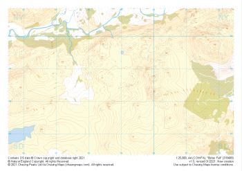 "Birker Fell" Natural Features£4.99
1:25,000 scale map covering Birker Fell in the Lake District (approx. center SD190986).
Learn More