Contour Mapping
-
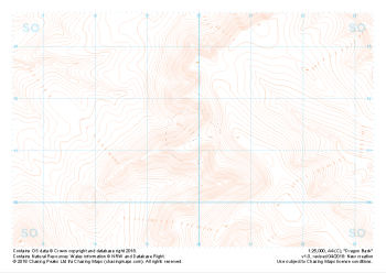
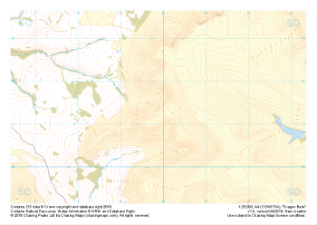 "Dragon Back" Major Hazards£4.99
1:25,000 scale map covering the Dragon's Back in the Brecon Beacons (approx. center SO175305).
Known as Y Grib, the small but defined ridge of the Dragon's Back rises up onto the plateau of the Black Mountains.
Learn More -
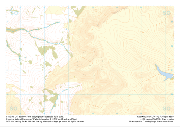 "Dragon Back" Natural Features£4.99
1:25,000 scale map covering the Dragon's Back in the Brecon Beacons (approx. center SO175305).
Known as Y Grib, the small but defined ridge of the Dragon's Back rises up onto the plateau of the Black Mountains.
Learn More -
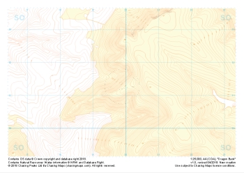 "Dragon Back" Landform+£4.99
1:25,000 scale map covering the Dragon's Back in the Brecon Beacons (approx. center SO175305).
Known as Y Grib, the small but defined ridge of the Dragon's Back rises up onto the plateau of the Black Mountains.
Learn More -
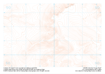 "Dragon Back" Landform£4.99
1:25,000 scale map covering the Dragon's Back in the Brecon Beacons (approx. center SO175305).
Known as Y Grib, the small but defined ridge of the Dragon's Back rises up onto the plateau of the Black Mountains.
Learn More -
 "Dragon Back" Contour Only£4.99
1:25,000 scale map covering the Dragon's Back in the Brecon Beacons (approx. center SO175305).
Known as Y Grib, the small but defined ridge of the Dragon's Back rises up onto the plateau of the Black Mountains.
Learn More -
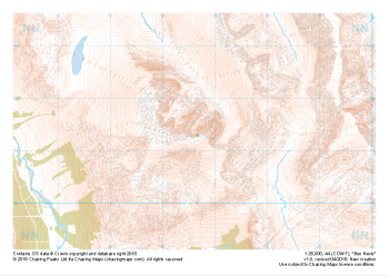 "Ben Nevis / Beinn Nibheis" Natural Features£4.99
1:25,000 scale map covering Ben Nevis in the Scottish Highlands (approx. center NN165715).
The UK's highest mountain not only forms part of the national 3 peaks challenge but also boasts one of the most challenging descents in poor weather off any "easily walkable" mountain on our isles.
Learn More -
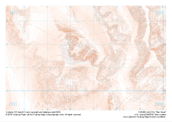 "Ben Nevis / Beinn Nibheis" Landform£4.99
1:25,000 scale map covering Ben Nevis in the Scottish Highlands (approx. center NN165715).
The UK's highest mountain not only forms part of the national 3 peaks challenge but also boasts one of the most challenging descents in poor weather off any "easily walkable" mountain on our isles.
Learn More -
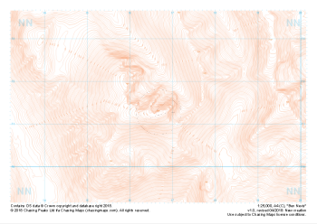 "Ben Nevis / Beinn Nibheis" Contour Only£4.99
1:25,000 scale map covering Ben Nevis in the Scottish Highlands (approx. center NN165715).
The UK's highest mountain not only forms part of the national 3 peaks challenge but also boasts one of the most challenging descents in poor weather off any "easily walkable" mountain on our isles.
Learn More -
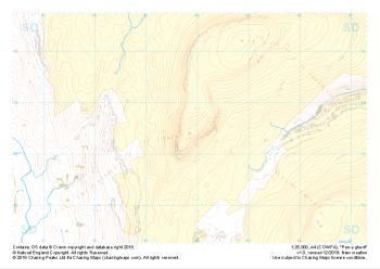
 "Pen-y-ghent" Major Hazards£4.99
1:25,000 scale map covering Pen-y-ghent in the Yorkshire Dales (approx. center SD839734).
Learn More -
 "Pen-y-ghent" Natural Features£4.99
1:25,000 scale map covering Pen-y-ghent in the Yorkshire Dales (approx. center SD839734).
Learn More