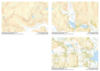
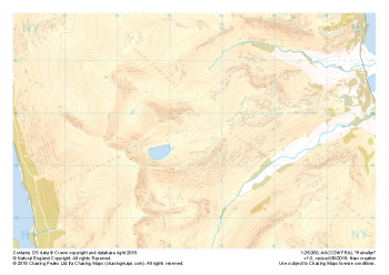
Our "Major Hazards" map contains the "full works" of features we have identified as suitable to put land forms into context. Showing you contours at 5m or 10m intervals, rocky features, major streams, woodland, major roads and railway lines, this map removes a lot of the "distracting clutter" found on more detailed maps. While we always recommend carrying a standard walking map as backup, this series is a perfect introduction to navigation by natural features.
Major Hazards
-
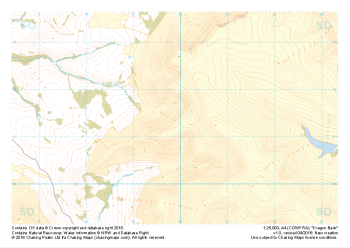 "Dragon Back" Major Hazards£4.99
1:25,000 scale map covering the Dragon's Back in the Brecon Beacons (approx. center SO175305).
Known as Y Grib, the small but defined ridge of the Dragon's Back rises up onto the plateau of the Black Mountains.
Learn More -
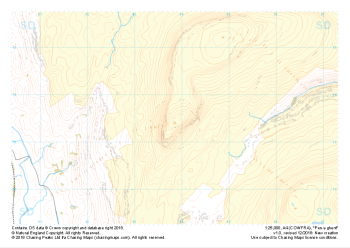 "Pen-y-ghent" Major Hazards£4.99
1:25,000 scale map covering Pen-y-ghent in the Yorkshire Dales (approx. center SD839734).
Learn More -
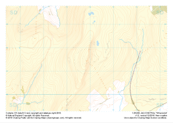 "Whernside" Major Hazards£4.99
1:25,000 scale map covering Whernside in the Yorkshire Dales (approx. center SD738814).
Learn More -
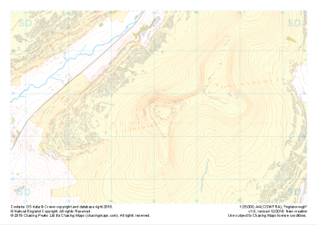 "Ingleborough" Major Hazards£4.99
1:25,000 scale map covering Ingleborough in the Yorkshire Dales (approx. center SD741746).
Learn More -
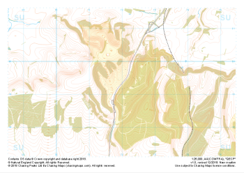 "QECP" Major Hazards£4.99
1:25,000 scale map covering QECP in the South Downs (approx. center SU720192).
Learn More -
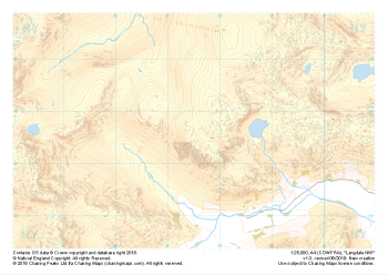 "Langdale NW" Major Hazards£4.99
1:25,000 scale map covering Langdale's North West corner (approx. center NY275075).
Known for its stunning countryside, tricky navigational terrain and beautiful wild camping spots, the Langdale Fells provide a true mountain adventure for every type of explorer.
Learn More -
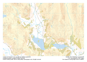 "Langdale NE" Major Hazards£4.99
1:25,000 scale map covering Langdale's North East corner (approx. center NY345075).
Known for its stunning countryside, tricky navigational terrain and beautiful wild camping spots, the Langdale Fells provide a true mountain adventure for every type of explorer.
Learn More -
 "Langdale SE" Major Hazards£4.99
1:25,000 scale map covering Langdale's South East corner (approx. center NY345035).
Known for its stunning countryside, tricky navigational terrain and beautiful wild camping spots, the Langdale Fells provide a true mountain adventure for every type of explorer.
Learn More -
 "Langdale Collection" Major Hazards£8.99
Set of 1:25,000 scale maps covering the Langdale Valley and surrounding area.
Known for its stunning countryside, tricky navigational terrain and beautiful wild camping spots, the Langdale Fells provide a true mountain adventure for every type of explorer.
Learn More -
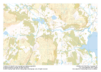
 "Helvellyn" Major Hazards£4.99
1:25,000 scale map covering Helvellyn (approx. center NY354155).
Helvellyn stands as one of the best known peaks in the Lake District National Park. Home to the stunning horseshoe comprising the classic scrambles of Swirral Edge and Striding Edge as well as the Lake District Fell Top Assessors during the winter months providing the mountain community with vital updates on ground conditions for the wider area. While she can be beautiful and calm in any season she is also known to show her teeth and accidents on the edges are frequent, especially in the winter months.
Learn More