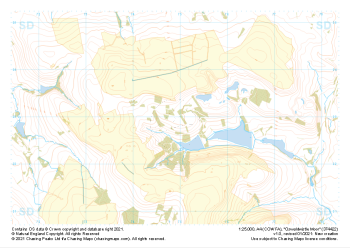
Our "Natural Features" maps show the landforms (contours and rocky areas) in context of larger streams and forests. By providing a little more detail than our "Landform" or "Contour Only" range, these maps are slightly easier to use and especially good for teaching navigation by contours and land forms to those with limited experience in this area. This series also includes Access Land in England and Wales, as well as the customary national grid overlay to allow for effective bearing and grid reference work.
Natural Features
-
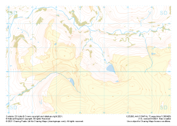
 "Darwen Moor" Natural Features£4.99
1:25,000 scale map covering Darwen Moor in the Midlands (approx. center SD683191).
Learn More -
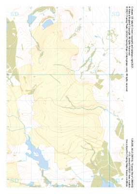
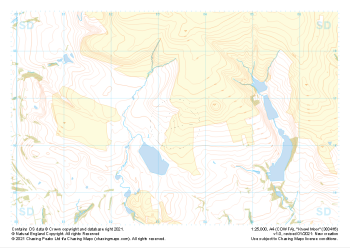
 "Rivington Pike" Natural Features£4.99
1:25,000 scale map covering Rivington Pike in the Midlands (approx. center SD670137).
Learn More -
 "Oswaldwistle Moor" Natural Features£4.99
1:25,000 scale map covering Oswaldwistle Moor in the Midlands (approx. center SD749230).
Learn More -
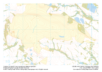
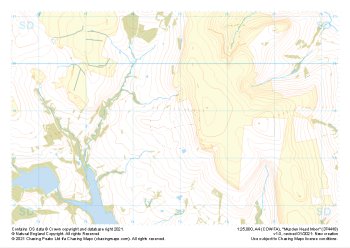 "Musden Head Moor" Natural Features£4.99
1:25,000 scale map covering Musden Head Moor in the Midlands (approx. center SD749188).
Learn More -
 "Cowpe Moss" Natural Features£4.99
1:25,000 scale map covering Cowpe Moss in the Midlands (approx. center SD833205).
Learn More -
 "Knowl Moor" Natural Features£4.99
1:25,000 scale map covering Knowl Moor in the Midlands (approx. center SD834166).
Learn More -
 "Whitworth" Natural Features£4.99
1:25,000 scale map covering Whitworth in the Midlands (approx. center SD889189).
Learn More -
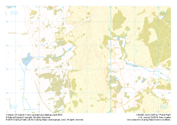 "Picket Plain" Natural Features£4.99
1:25,000 scale map covering Picket Plain in the South West (approx. center SU191043).
Learn More -
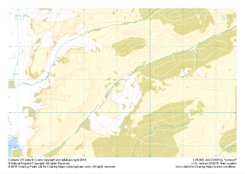 "Linwood" Natural Features£4.99
1:25,000 scale map covering Linwood in the South West (approx. center SU192108).
Learn More -
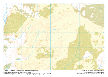 "Ashley Walk" Natural Features£4.99
1:25,000 scale map covering Ashley Walk in the South West (approx. center SU202156).
Learn More