Our "Natural Features" maps show the landforms (contours and rocky areas) in context of larger streams and forests. By providing a little more detail than our "Landform" or "Contour Only" range, these maps are slightly easier to use and especially good for teaching navigation by contours and land forms to those with limited experience in this area. This series also includes Access Land in England and Wales, as well as the customary national grid overlay to allow for effective bearing and grid reference work.
Natural Features
-
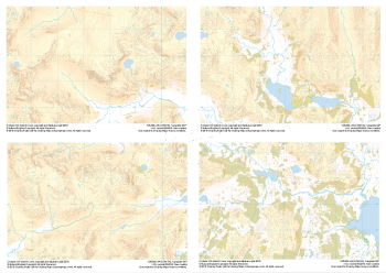 "Langdale Collection" Natural Features£9.99
Set of 1:25,000 scale maps covering the Langdale Valley and surrounding area.
Known for its stunning countryside, tricky navigational terrain and beautiful wild camping spots, the Langdale Fells provide a true mountain adventure for every type of explorer.
Learn More