Our "Natural Features" maps show the landforms (contours and rocky areas) in context of larger streams and forests. By providing a little more detail than our "Landform" or "Contour Only" range, these maps are slightly easier to use and especially good for teaching navigation by contours and land forms to those with limited experience in this area. This series also includes Access Land in England and Wales, as well as the customary national grid overlay to allow for effective bearing and grid reference work.
Natural Features
-
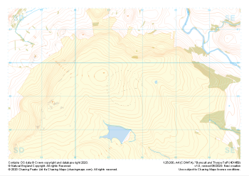 "Burnsall and Thorpe Fell" Natural Features£4.99
1:25,000 scale map covering Burnsall and Thorpe Fell in the North Yorkshire (approx. center SE015593).
Learn More -
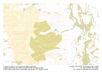
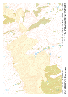 "Moel Famau West" Natural Features£4.99
1:25,000 scale map covering Moel Famau West in the North Wales (approx. center SJ153645).
Learn More -
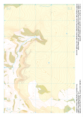 "Eglwyseg Mountain" Natural Features£4.99
1:25,000 scale map covering Eglwyseg Mountain in the North Wales (approx. center SJ233465).
Learn More -
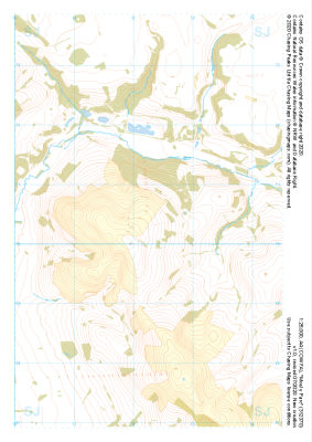 "Moel y Parc" Natural Features£4.99
1:25,000 scale map covering Moel y Parc in the North Wales (approx. center SJ123703).
Learn More -
 "Moel Famau South" Natural Features£4.99
1:25,000 scale map covering Moel Famau South in the North Wales (approx. center SJ175623).
Learn More -
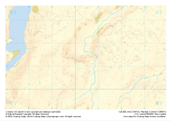 "Mardale Common" Natural Features£4.99
1:25,000 scale map covering Mardale Common in the Lake District (approx. center NY505113).
Learn More -
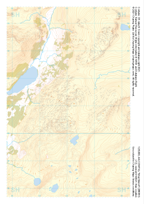
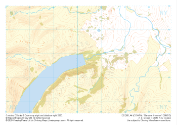 "Bampton Common" Natural Features£4.99
1:25,000 scale map covering Bampton Common in the Lake District (approx. center NY505158).
Learn More -
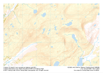
 "Moel Meirch" Natural Features£4.99
1:25,000 scale map covering Moel Meirch in the North Wales (approx. center SH661511).
Learn More -
 "Dolwyddelan West" Natural Features£4.99
1:25,000 scale map covering Dolwyddelan West in the North Wales (approx. center SH703511).
Learn More -
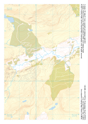
 "Blaenau Ffestiniog West" Natural Features£4.99
1:25,000 scale map covering Blaenau Ffestiniog West in the North Wales (approx. center SH661466).
Learn More