We're constantly adding to our selection of pre-defined areas. Take a look at the map below to see where we have already covered or which areas are about to be released. We're still working on the interactive map and how it integrates with our shop, so please bear with us while we add functionality.
Mapping shown in the interactive map is intended for overview purposes only and does not represent the mapping provided in our products.
Areas
-
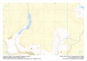 "Wadsworth Moor" Major Hazards£4.99
1:25,000 scale map covering Wadsworth Moor in the Midlands (approx. center SD980334).
Learn More -
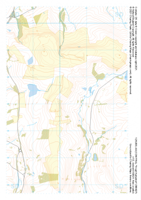
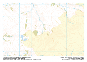 "Boulsworth Hill" Major Hazards£4.99
1:25,000 scale map covering Boulsworth Hill in the Midlands (approx. center SD920369).
Learn More -
 "Heptonstall Moor East" Major Hazards£4.99
1:25,000 scale map covering Heptonstall Moor East in the Midlands (approx. center SD954284).
Learn More -
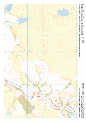
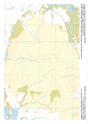
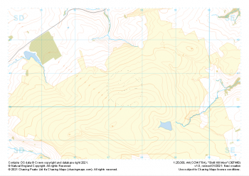 "Stott Hill Moor" Major Hazards£4.99
1:25,000 scale map covering Stott Hill Moor in the Midlands (approx. center SD975407).
Learn More -
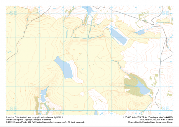 "Oxenhope Moor" Major Hazards£4.99
1:25,000 scale map covering Oxenhope Moor in the Midlands (approx. center SE041321).
Learn More -
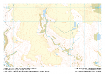 "Midgley Moor" Major Hazards£4.99
1:25,000 scale map covering Midgley Moor in the Midlands (approx. center SE027290).
Learn More -
 "Worsthorne Moor" Major Hazards£4.99
1:25,000 scale map covering Worsthorne Moor in the Midlands (approx. center SD908284).
Learn More -
 "Great Hameldon" Major Hazards£4.99
1:25,000 scale map covering Great Hameldon in the Midlands (approx. center SD803271).
Learn More -
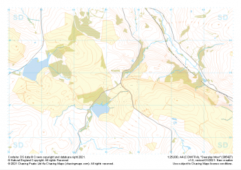 "Deerplay Moor" Major Hazards£4.99
1:25,000 scale map covering Deerplay Moor in the Midlands (approx. center SD854277).
Learn More -
 "Wheelton Moor" Major Hazards£4.99
1:25,000 scale map covering Wheelton Moor in the Midlands (approx. center SD642188).
Learn More