Dartmoor
-
 "Cosdon Hill" Collection£9.99
1:25,000 scale map covering Cosdon Hill in the Dartmoor (approx. center SX644908).
Learn More -
 "Fernworthy North" Collection£9.99
1:25,000 scale map covering Fernworthy North in the Dartmoor (approx. center SX655855).
Learn More -
 "Holne Moor" Collection£9.99
1:25,000 scale map covering Holne Moor in the Dartmoor (approx. center SX667695).
Learn More -
 "Crownhill Down" Collection£9.99
1:25,000 scale map covering Crownhill Down in the Dartmoor (approx. center SX574608).
Learn More -
 "Lee Moor" Collection£9.99
1:25,000 scale map covering Lee Moor in the Dartmoor (approx. center SX598661).
Learn More -
 "Erme Plains" Collection£9.99
1:25,000 scale map covering Erme Plains in the Dartmoor (approx. center SX639661).
Learn More -
 "Dean Moor" Collection£9.99
1:25,000 scale map covering Dean Moor in the Dartmoor (approx. center SX682661).
Learn More -
 "Stall Moor South" Collection£8.99
1:25,000 scale map covering Stall Moor South in the Dartmoor (approx. center SX619618).
Learn More -
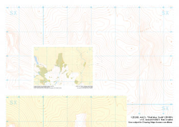
 "Merrivale" Collection£9.99
Our full set of 1:25,000 scale maps covering the area of the Merrivale Range on Dartmoor (approx. center SX590785).
The area of the Merrivale Range on Dartmoor lies to the South of the large expanse of the Okehampton Range. Here, exploring the remains of ancient settlements can provide a welcome distraction from boggy ground and seemingly identical landscape over every mound. Perfectly suited to provide even the most skilled mountain navigator with a tough challenge, there is a very good reason the MoD trains our country's soldiers on Dartmoor in the dark art of navigating.
Live firing and exercise times are published by the MoD and a quick search for "Dartmoor firing times" should form part of your planning in this area. On the ground red flags by day and red lights at night will show the range is being used for live firing and it is in your best interest to not cross and indeed steer well clear of the line of red and white marker posts.
Learn More