Our "Natural Features" maps show the landforms (contours and rocky areas) in context of larger streams and forests. By providing a little more detail than our "Landform" or "Contour Only" range, these maps are slightly easier to use and especially good for teaching navigation by contours and land forms to those with limited experience in this area. This series also includes Access Land in England and Wales, as well as the customary national grid overlay to allow for effective bearing and grid reference work.
Natural Features
-
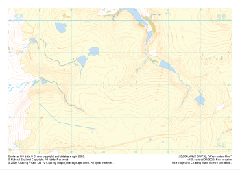 "Wessenden Moor" Natural Features£4.99
1:25,000 scale map covering Wessenden Moor in the Peak District (approx. center SE045080).
Learn More -
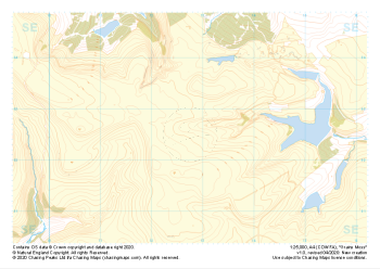 "Grains Moss" Natural Features£4.99
1:25,000 scale map covering Grains Moss in the Peak District (approx. center SE128025).
Learn More -
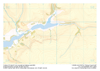 "Shining Clough North" Natural Features£4.99
1:25,000 scale map covering Shining Clough North in the Peak District (approx. center SK095990).
Learn More -
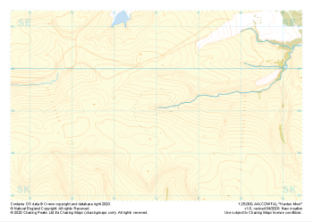 "Harden Moor" Natural Features£4.99
1:25,000 scale map covering Harden Moor in the Peak District (approx. center SK160990).
Learn More -
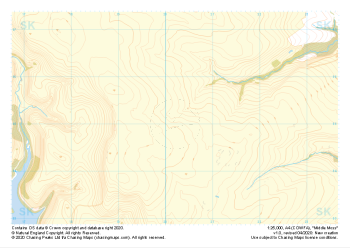 "Middle Moss" Natural Features£4.99
1:25,000 scale map covering Middle Moss in the Peak District (approx. center SK202950).
Learn More -
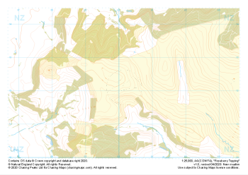 "Roseberry Topping" Natural Features£4.99
1:25,000 scale map covering Roseberry Topping in the Yorkshire Dales (approx. center NZ602121).
Learn More -
 "Eskdale" Natural Features£4.99
1:25,000 scale map covering Eskdale in the Lake District (approx. center NY210030).
Thank you to Chris Ensoll Mountain Guide for sponsoring our maps of this area for the wider outdoor community. Learn More -
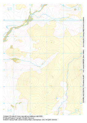 "Princetown North" Natural Features£4.99
1:25,000 scale map covering Princetown North in the Dartmoor (approx. center SX538775).
Learn More -
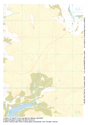 "Princetown West" Natural Features£4.99
1:25,000 scale map covering Princetown West in the Dartmoor (approx. center SX573715).
Learn More -
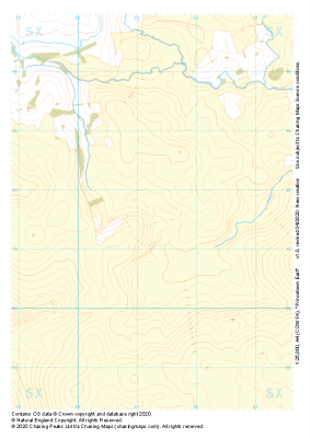 "Princetown East" Natural Features£4.99
1:25,000 scale map covering Princetown East in the Dartmoor (approx. center SX613715).
Learn More